Story | 12 December 2024
Investigating the mesophotic mysteries of Ascension Island to support effective marine conservation
PML’s Professor Kerry Howell is currently in Ascension Island, a remote volcanic island in the South Atlantic Ocean, to gather biodiversity and physical environment data that will support the Ascension Island Government to effectively manage fisheries, quantify carbon sequestration and assess threats to the Marine Protected Area.
Professor Kerry Howell – Professor of Deep-Sea Ecology at Plymouth Marine Laboratory and the University of Plymouth – is leading a DEFRA Darwin Initiative-funded project: ‘Building baseline knowledge of mesophotic* ecosystems in Ascension Island MPA’. The project, which began in April 2024, is a collaboration between the Ascension Island Government, Plymouth Marine Laboratory and the University of Plymouth, and will be running for 2 years.
*Mesophotic means “middle-light” and refers to ecosystems that exist in low light conditions at depths of 30m to 300m.

Image above: Professor Kerry Howell sat on the bow of a RIB in the Ascension Island Marine Protected Area
Professor Howell describes the necessity to investigate these ecosystems:
“The biology of mesophotic systems is often poorly known because they are difficult to access. They are beyond recreational SCUBA diver depth and can only be studied using advanced and technical diving, or camera systems deployed on the seafloor.”
“Generally, deployment of such camera systems to mesophotic depth requires a reasonably large vessel to work from, because systems can be heavy, and deep water can be far from land. At Ascension, as in many other island communities, there are no large research vessels available, but deep water is actually very close to shore and can be easily accessed from a small boat. So, we have developed a low cost, lightweight, drift camera system, to enable us to survey the marine flora and fauna on the seabed from a RIB.”


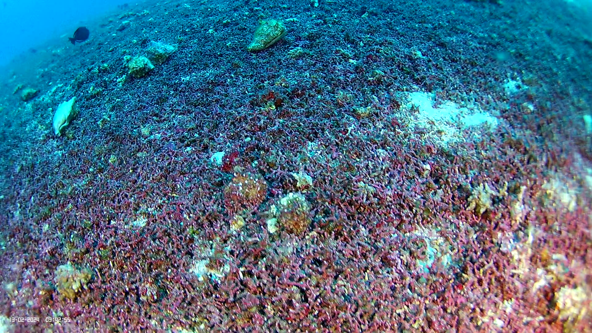
Images above: Colleagues lower the lightweight drift camera system to survey the marine flora and fauna on the seabed
“We have been working with the Ascension Island Government marine team using our drift camera to observe life on the seabed from 30 to 100m. We are working on both the sheltered and exposed side of the island to ensure we capture the full range of environmental conditions present.”
Explore some of the photos taken of the seabed from the camera system below:


“Early next year our partners from the University of Plymouth will again work with the island marine team to study the oceanographic conditions at our biodiversity observation sites, and together we will shed light on what lives here, and how the oceanographic conditions influence their distribution.”
“It is hoped that the data from this project will deliver biodiversity and physical environment data that will support the Ascension Island Government to effectively manage fisheries, quantify carbon sequestration and assess threats to the MPA. There is a strong emphasis on training within the project, to build on-island capacity for long-term monitoring and management.”

Image above: Dolphins jumping from the water alongside the RIB
About the Ascension Island Marine Protected Area…
‘In 2019, Ascension Island’s entire 445,000km2 marine zone was declared a Marine Protected Area (MPA), where no large-scale commercial fishing or seabed mining is permitted. This makes the Ascension Island MPA one of the largest areas of highly protected ocean in the world.
It supports many species that are found nowhere else on earth, deep sea and open ocean habitats that remain largely untouched and unexplored, and thousands of nesting turtles and seabirds that take advantage of a speck of dry land in the middle of the Atlantic. The MPA seeks to protect all of these and the natural processes that sustain them.’
[Source: Ascension Island Marine Protected Area]
