Project
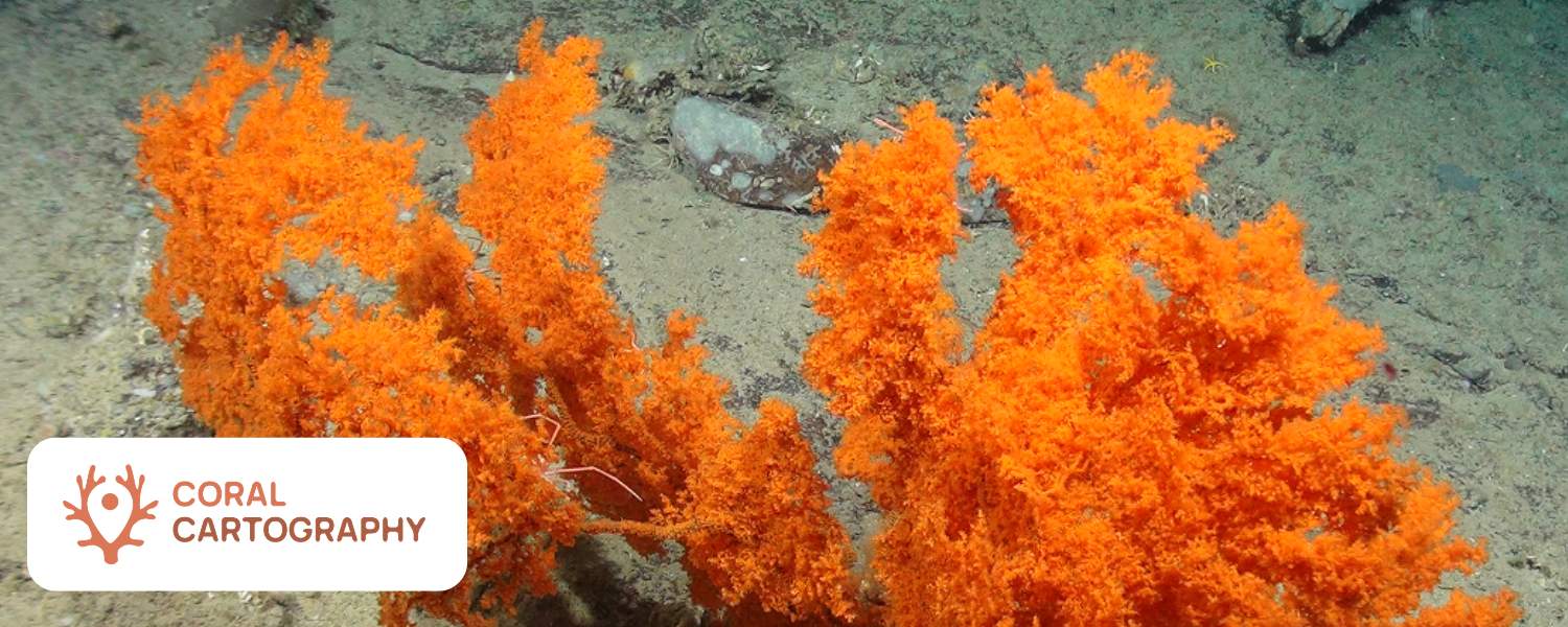
Coral Cartography: Mapping Atlantic Cold-Water Corals to support Area Based Management
Active project
Project Start: September 2025 | Project End: March 2028
Project Funder: CORDAP
Principal Investigator: Professor Kerry Howell
Other Participants: Dr. David Moffat
Project Website: https://coralcartography.org/
Coral Cartography uses deep-sea imagery to map the distribution and density of cold-water corals across the Atlantic Ocean. By combining marine ecology, environmental data and AI-enabled analysis, the project delivers new evidence to support the protection and sustainable management of vulnerable deep-sea ecosystems.
Project overview
Cold-water corals are vital components of deep-sea ecosystems across the Atlantic Ocean. They create structurally complex habitats that support high biodiversity and contribute to the resilience and functioning of ocean systems. Despite their importance, large areas of the Atlantic—particularly in deeper and less surveyed regions—remain poorly characterised, with significant gaps in our understanding of coral distribution, density, and ecological role.
This project aims to address these gaps, with a particular focus on the Central and South Atlantic, regions that remain underexplored compared to the North Atlantic. It brings together nations from across the Atlantic to collaborate on mapping and analysing cold-water coral distribution in these data-poor areas. A key component is the standardisation of datasets from various Atlantic partners to create a unified resource for high-resolution cold-water coral density mapping across the basin. AI methods will be used to accelerate image analysis, unlocking valuable data reserves.
The project will develop the most advanced maps of cold-water coral distribution to date, which will support area-based management of the deep ocean and the new High Seas Treaty. From Plymouth Marine Laboratory’s perspective, the project aligns strongly with our mission to deliver interdisciplinary, digitally enabled science that supports sustainable ocean management.
Project aims
The project aims to transform how cold‑water coral ecosystems are observed, analysed and represented at ocean‑basin scale by:
- Creating a standardised, quality‑controlled dataset of cold‑water coral imagery and annotations.
- Developing and applying AI‑based tools to detect, classify and quantify cold‑water corals from seabed imagery.
- Producing spatially explicit maps of coral distribution, density and diversity across the Atlantic Ocean.
PML’s contribution
Plymouth Marine Laboratory is project lead, contributing expertise in marine biodiversity, environmental data integration and artificial intelligence for ocean science. PML researchers support the development of robust analytical workflows that combine biological observations with physical and environmental data, enabling scalable and repeatable mapping of vulnerable marine ecosystems.
Through this work, PML helps ensure that project outputs are scientifically robust, policy‑relevant and aligned with international best practice in open and reproducible science.
How the project works
Existing and newly collected deep‑sea imagery is brought together from across the Atlantic. Consistent annotation standards and quality‑control procedures are applied to ensure the data are suitable for large‑scale analysis. Expert taxonomists help to ensure corals are correctly identified.
AI is used to help humans to analyse the large reserve of seafloor image data. AI helps detect corals that humans then identify and quantify.
Biological data are combined with environmental variables such as depth, temperature and oceanographic conditions to generate habitat suitability models. These models underpin Atlantic‑wide maps of cold‑water coral distribution and density.
Subscribe to our newsletter
Stay Up To Date
Subscribe to our newsletter for information on our latest research, upcoming events and seminars and more.
Join our newsletter