Sea The Value – Blogs
The Sea The Value blogs explores the connections between people and the marine environment, highlighting research, innovations, and community engagement in marine sustainability. Through a range of blog posts, it showcases how science, policy, and local knowledge come together to support ocean health and sustainable development.
Sea the Value at Coastal Futures 2025
Participatory Mapping: Putting Local Knowledge on the Map
Sea the Value at Coastal Futures 2025: Highlighting the Role of Marine Ecosystems in Carbon Sequestration & Bioremediation.
By Daryl Burdon
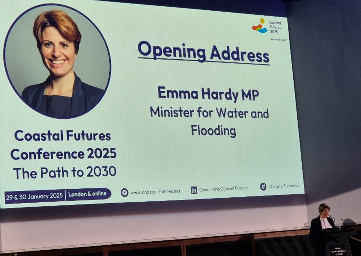
Coastal Futures 2025 took place at the Royal Geographical Society in London on 29-30 January 2025. The event was attended by 550 people in person, in addition to online attendees, representing UK and international policy, practitioners, industry and research/academia. The theme of the conference was the Path to 2030 and covered a broad range of topics including:
- How do we improve the quality of place-based decision-making?
- Can we meet the 2030 targets whilst growing a sustainable blue economy?
- What insights can we gain from international best practice to help us reach 2030 targets?
- Are we doing enough to understand and promote the value of our seas?
- How will future fishing be balanced with restoration efforts & space for renewable energy? and
- Can we achieve well-managed and restored marine and coastal seascapes by 2030?
The conference was opened by Emma Hardy MP Minister for Water and Flooding who emphasised the importance of nature in underpinning our national economy.
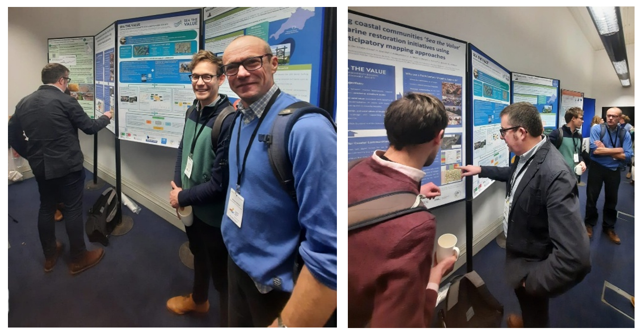
The Sea the Value team was well represented at the event by Dr Daryl Burdon (Daryl Burdon Ltd.), Prof Tavis Potts (University of Aberdeen), Prof. Gordon Watson (University of Portsmouth), Dr Mark Collar (eftec), Claire Szostek (PML), and Alice Watts (Coastal Partnership Network).
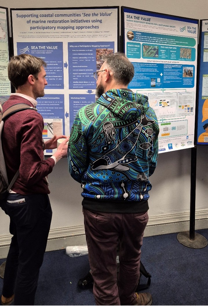
Two posters were presented on the Sea the Value Research. The first provided an overview of the Sea the Value project demonstrating how our research investigates the value of our marine systems in delivering carbon sequestration and bioremediation of waste benefits for society. The second poster presented focussed on the outputs of a series of three participatory mapping workshops, undertaken in collaboration with coastal partnerships and communities in the Cromarty Firth and the Solent.
Additional Sea the Value material, in the form of postcards and business cards, was distributed via the Coastal Partnership Network stand.
Overall, the conference provided an excellent opportunity to share the ongoing research undertaken within the Sea the Value project to key marine stakeholders within the UK.
Participatory Mapping: Putting Local Knowledge on the Map
By Daryl Burdon
When it comes to understanding a place, who knows it better than the people who live there? Yet in many projects local insights get overlooked and decisions are made using existing ‘data’. Sea the Value is determined to avoid this flawed approach and is using a process called Participatory Mapping to make sure local voices aren’t just heard but are at the centre of decision-making and planning.

What is Participatory Mapping?
Participatory Mapping is all about getting communities involved in mapping out their own environments. Groups work through a series of facilitated workshops, where they draw their local area onto a map and talk about the different natural, managed and man-made features, and have conversations about what benefits these features bring to the various aspects of local life.
This approach doesn’t require a background in science or finance, but instead relies on organic observations and descriptions, and discussions with the facilitators and other members of the community. It’s about tapping into what locals already know about their land and sea and turning that knowledge into valuable insights for scientists and policymakers.

Why Does Participatory Mapping Matter?
Local communities often hold the key to understanding local environments— providing details and nuances that outsiders might miss. Additionally, without local knowledge scientists often end up basing their work on outdated and therefore inaccurate maps of local areas. Unfortunately, many projects move forward without truly engaging the people who know the land and sea best, leading to outcomes that don’t always align with local needs.
Participatory Mapping changes this. It gives locals an inclusive platform to share their knowledge, from natural features to the cultural and ecological importance of those features. Policymakers and scientists then build on this foundation, ensuring that decisions are grounded in local realities, not just external ideas.

How Sea the Value Uses Participatory Mapping
Participatory Mapping is a key part of the Sea the Value project, which focuses on two case study sites in the UK: the Solent (England) and the Cromarty Firth (Scotland). Through a series of workshops, local communities help map out marine features and the benefits they provide, such as the bioremediation of waste and carbon sequestration.

Here’s a quick breakdown of the workshops:
- Workshop 0: Getting to Know Each Other – This session is all about introductions, warming up for the deeper discussions to come.
- Workshop 1: Mapping the Environment – Participants map natural, managed and man-made features of their local environment, identifying the benefits each one provides for the community.
- Workshop 2: Exploring Future Scenarios – In this workshop, participants review their maps and discuss possible future scenarios, weighing the trade-offs of future management scenarios.
- Workshop 3: Connecting Benefits to Community Well-being – The final session digs into how individuals and organisations within communities rely on these benefits and how they can be maintained or enhanced.
What Participants Are Saying
Feedback from these workshops has been overwhelmingly positive. Participants loved the chance to connect, share different perspectives, and have meaningful discussions about their local marine environment. One person mentioned the value of discussing how to use the maps for community planning, while another highlighted the importance of bringing people together to talk about the future of the Cromarty Firth.
Everyone walked away with a stronger understanding of how benefits from natural features are tied to community well-being—a testament to the power of Participatory Mapping in building deeper connections between people and their local environment.

Looking Ahead: Keeping the Momentum Going
With all workshops completed at both sites, the Sea the Value team is exploring ways to support these local groups beyond the project. The communities involved are eager to keep this work going, ensuring that local knowledge continues to shape environmental planning and management.
Want to Get Involved?
Participatory Mapping is more than just a tool—it’s a movement towards more inclusive and sustainable decision-making. By putting local communities at the heart of environmental planning, Sea the Value is leading the way in creating a future where policy and science truly listen to and learn from the people who know their land and seascapes best.
Curious to learn more? Stay tuned for updates or reach out to our project team. Together, we can ensure that local voices lead the way in shaping our shared environmental future.
