Story
Singular Mission to Chart Atlantic's Deep-Sea Biodiversity in focus at UNOC3
10 June 2025
More than 40 international researchers joined a gathering in Nice to discuss Atlantic Ocean deep sea life mapping initiative, led by PML’s Prof Kerry Howell.
An international coalition of marine scientists convened in Nice today (June 10th) to discuss unprecedented collaborative efforts to map the biodiversity of the Atlantic Ocean’s deep-sea ecosystems, in turn enabling better protection for Vulnerable Marine Ecosystems (VMEs).
Spearheaded jointly by Professor Kerry Howell from Plymouth Marine Laboratory (PML) and Dr Ana Hilário of the University of Aveiro, who co-lead of the Challenger 150 programme, around 40 researchers from countries including Portugal, Argentina, Brazil, Colombia, Canada, Germany, Mauritania, Norway, Uruguay, the United States, and the United Kingdom gathered to discuss the urgency and challenges of a more joined-up and formalised approach to deep sea biodiversity monitoring.
The project aims to create comprehensive, high-resolution models of deep-sea species distribution across the Atlantic – ultimately developing a “spatial digital twin” of the ocean floor to inform conservation and spatial management decisions. This initiative would address a critical gap in current marine protection efforts, which are limited to areas where vulnerable marine ecosystems (VMEs) are already known to exist.
“Legislation requires states to protect VMEs where they are known or likely to occur. At present we only work with the known,” explained Professor Howell, PML’s Deep Sea Ecologist who was recently successful in securing a grant from the Bezos Earth Fund to use AI for deep sea biodiversity monitoring.
“It’s a huge oversight and extremely risky to limit conservation efforts to areas we have data on. The deep sea is so vast, and we haven’t looked everywhere.”
The new mapping initiative is a focus for the Challenger 150 programme, a global scientific cooperative developed to support the UN Ocean Decade objectives. The programme serves as a coordination vehicle for deep-sea research worldwide, working toward common conservation and scientific goals.
Dr Ana Hilario emphasised the collaborative nature required for success:
“Mapping these vulnerable ecosystems is not anything any one institute is capable of alone – it has to come from multiple organisations all pushing in the same direction. We need to align our objectives across projects in order to maximise the knowledge and understanding of these sensitive, vital ecosystems.”
The Atlantic’s deep-sea environments harbour remarkable biodiversity, including coral gardens that serve as vital habitats for numerous species. Professor Howell described how these ecosystems feature black corals that may be over 4,000 years old, extensive sponge communities, and deep-sea reefs that function as nurseries for sharks and other marine life.
Current data collection efforts are primarily driven by statutory fisheries programs, which focus predominantly on fish species rather than the broader ecosystem. This approach leaves significant knowledge gaps about other critical marine life and habitats.
Professor Howell highlighted how such a formalised mapping initiative would support work on the BBNJ agreement and address practical concerns for the fishing industry. Bottom trawling operations, as widely publicised in the new David Attenborough ‘Ocean’ documentary, can inadvertently destroy ancient coral reefs, creating “disasters for both the system and the fishing industry” as damaged nets represent significant economic losses.
Understanding the precise locations of these vulnerable ecosystems enables better planning of human activities while protecting irreplaceable marine habitats.
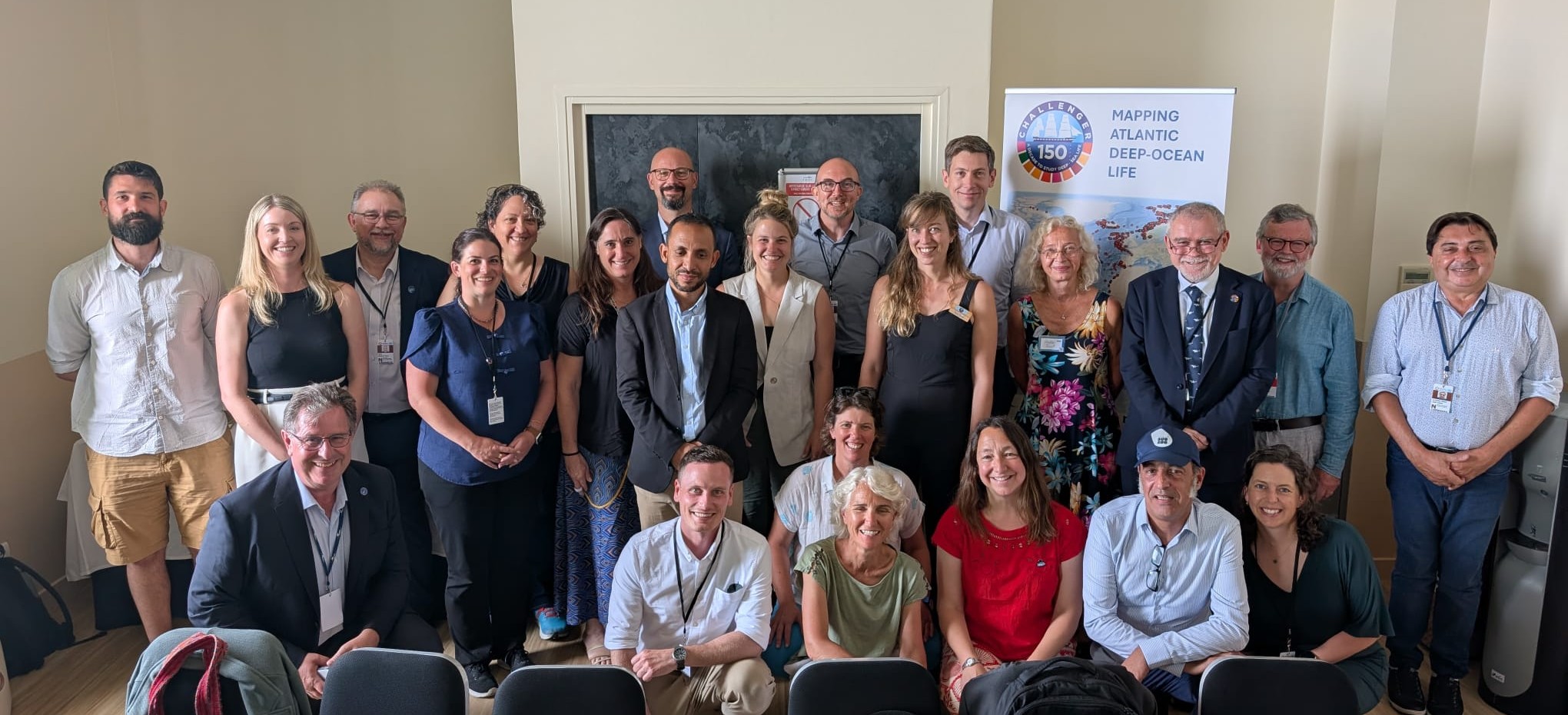
IMAGE: The researchers gathered in a packed conference room at Le Saint Paul Hotel
The meeting highlighted several technical challenges that must be addressed for the initiative’s success:
- Species Identification: Developing standardised protocols for identifying species from underwater imagery captured by tow cameras and remotely operated vehicles (ROVs)
- Taxonomic Consistency: Creating unified classification systems and standardised taxonomic databases to ensure consistent species identification across different regions and research teams
- Artificial Intelligence (AI) Applications: Addressing the challenges of applying AI to marine biodiversity analysis, including computing infrastructure needs and acceptable error standards
- Data Integration: Overcoming issues related to intellectual property, funding disparities, and inconsistent research techniques and standards
Dr. Lara Atkinson from the South African Environmental Observation Network emphasised the importance of standardisation and efforts to create a standardised operational taxonomic unit system while Nils Piechaud presented on the current challenges of AI application and the need for consistent approaches.
The Atlantic seafloor mapping concept was first discussed in 2024 during a meeting in Portugal involving members of the Challenger 150 Arctic, North, and Central and South Atlantic Regional Scientific Research Working Groups. The Nice meeting represents a significant step toward formalising this international collaboration.
“We can continue do this as a jigsaw, but it will take a lot longer,” Professor Howell noted. “If we can align things now, it will be a much easier job. All of us together could collectively realise this ambition.”
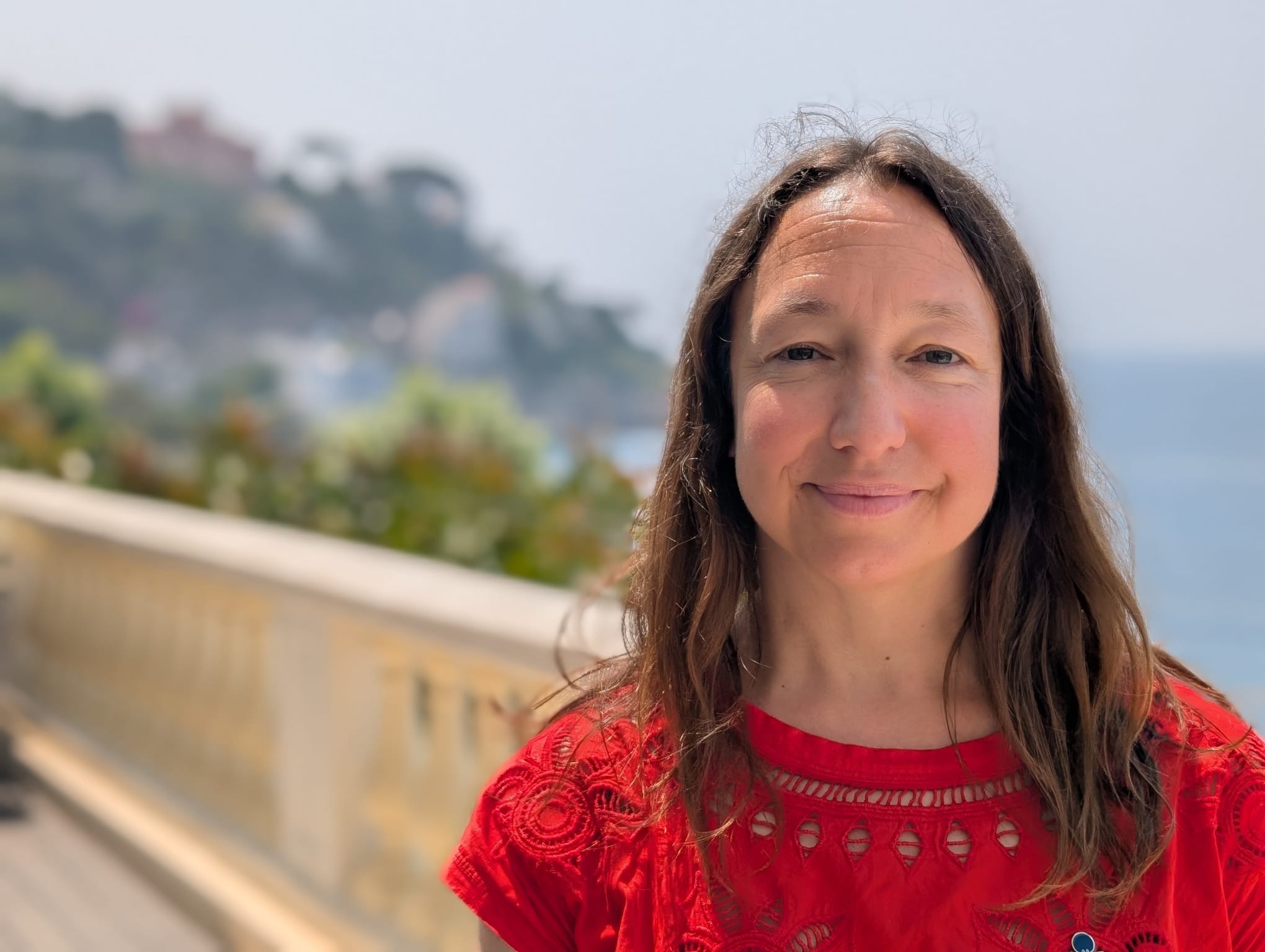
Image: Professor Kerry Howell in Nice
About Professor Howell
Kerry Howell is Professor of deep-sea ecology at the Plymouth Marine Laboratory and the University of Plymouth. She has expertise in use of ROVs and AUVs, seafloor imagery acquisition and analysis, predictive modelling of species distributions, and the application of deep-learning to image analysis.
Throughout her career Kerry’s research has been focused on sustainable management of the deep-sea ecosystem. Her research has supported the design of national and international marine protected area (MPA) networks, including the creation of reliable habitat maps, and models of population connectivity that underpin the design.
