Story
Following ocean currents to predict and prevent seabird deaths
15 December 2025
A new study seeks to support conservation and management strategies by identifying zones of overlap between fishing and bird activity.
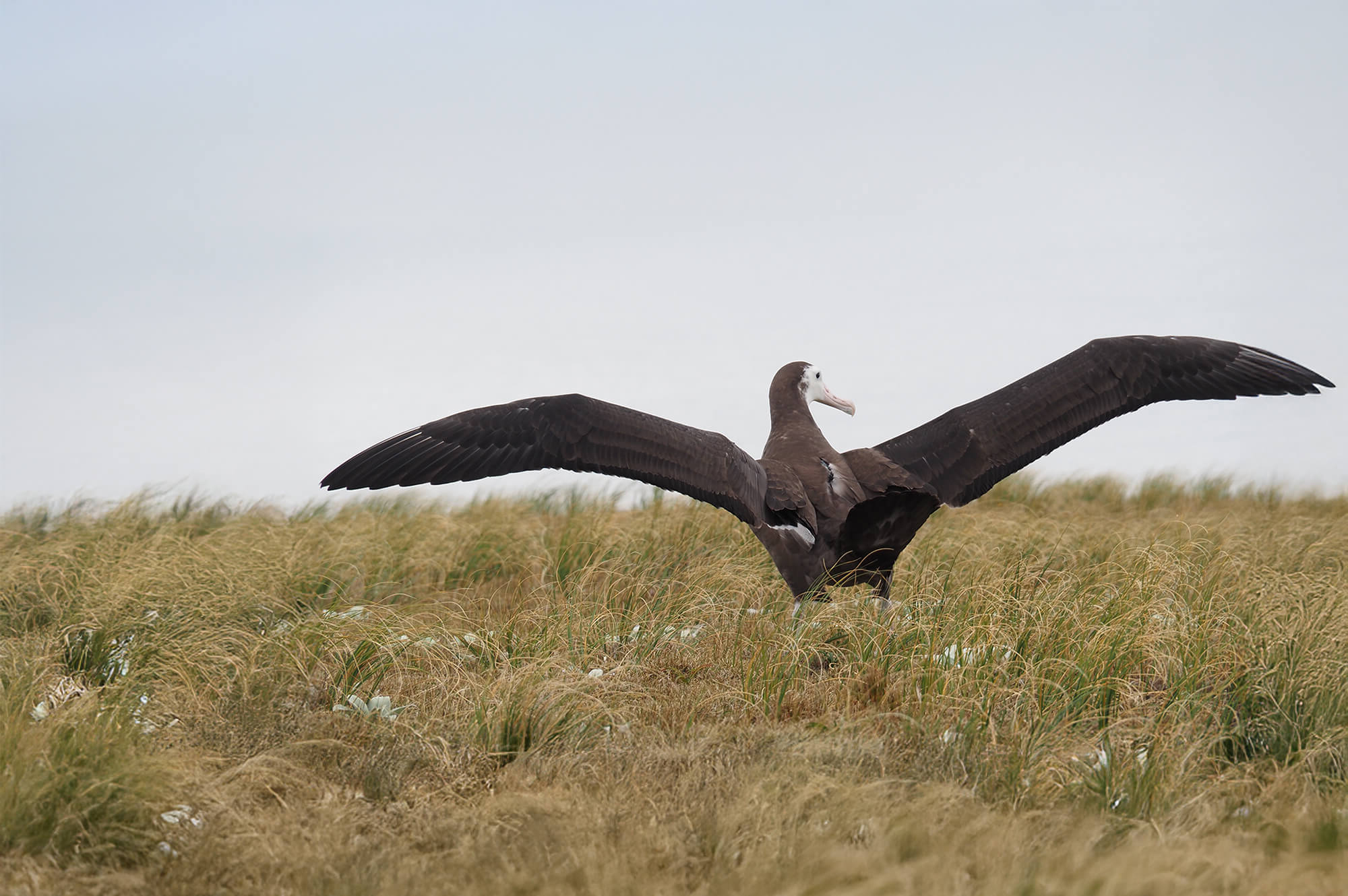
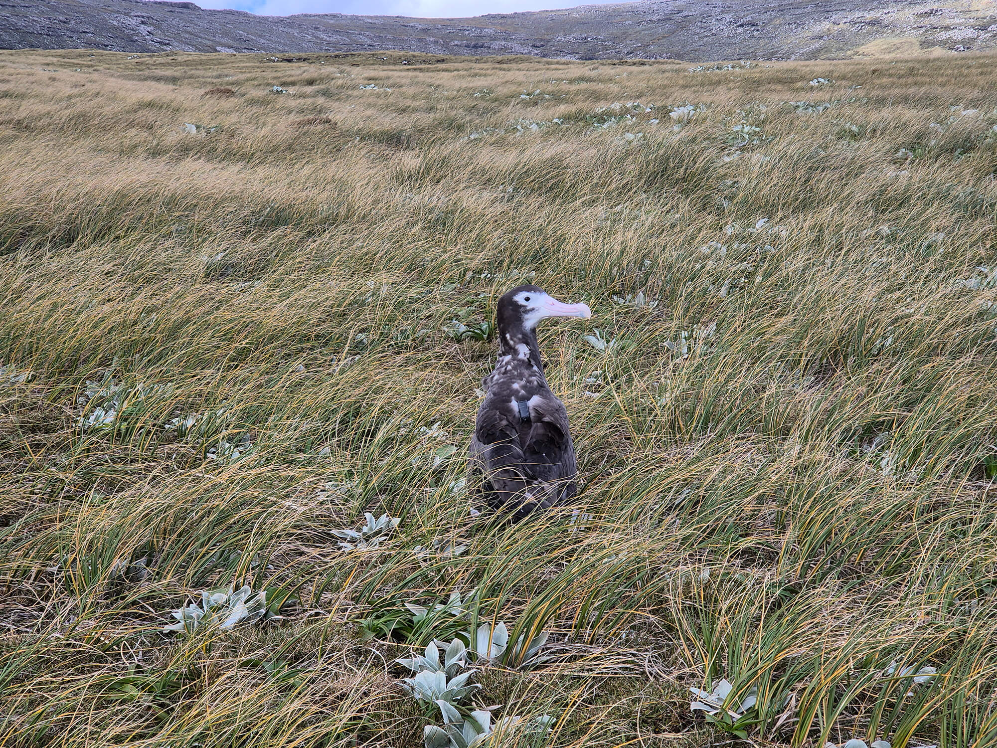
Albatross chick with satellite tag. Kath Walker, Graeme Elliott
Every year, thousands of seabirds die as unintended victims of commercial fishing – caught on hooks or becoming tangled in nets as they scavenge for food. An estimated 50,000 to 75,000 are killed by longline fishing fleets annually, with a staggering 170 million individuals exposed to bycatch risk worldwide.
In the Southern Hemisphere alone, 40,000 albatrosses and petrels are caught each year, and up to 90% of albatross species are now threatened by fishing activity. The Antipodean albatross, in particular, is at extreme risk. Endemic to New Zealand, the population of roughly 28,000 birds is declining at 6% per year – a devastating rate driven primarily by bycatch from high-seas longline fishing.
With the species being driven toward extinction, researchers needed to understand exactly where and when these fatal encounters are occurring.
As part of new study co-authored by PML alongside University of the Sunshine Coast and other institutes in Australia and New Zealand, and published in Biological Conservation journal, 192 Antipodean albatrosses across all demographics – males and females, juveniles and adults, breeding and non-breeding individuals – were fitted with tiny satellite transmitters. The full scope of the birds’ movements across the vast Southern Ocean was then overlaid with precise fishing vessel locations from the Automatic Identification System (AIS), which tracks commercial ships. This showed where birds and boats crossed paths – the basic “collision map.”
Critically, a third layer was then added: oceanographic data. PML’s expertise in Earth observation was used to examine how physical ocean features shape these danger zones. These data were analysed at two scales: seasonal patterns using long-term climate data, and finer monthly patterns using real-time ocean conditions.
By combining satellite tracking data with ocean information, the team could better understand how ocean features affect the area. These features include:
- Thermal fronts (zones where warm and cold water meet)
- Turbulent mixing (churning water)
- Eddies (currents rotating across tens of kms)
The analysis revealed that collision hotspots stretch across a vast area of ocean between 25°S and 40°S latitude, with risk levels changing throughout the year. The danger was shown to be particularly acute during the Southern Hemisphere winter months and with younger birds facing the highest risk of all.
When looking at large-scale, long-term ocean patterns, the riskiest areas were places where thermal fronts often occur. Zooming out to seasonal patterns, the team found that areas where temperature boundaries regularly form are consistently dangerous. Within monthly timescales, swirling ocean eddy structures (“aggregative Lagrangian Coherent Structures”) that concentrate prey create temporary but intense risk zones where hungry birds and active fishing boats converge.
PML Marine Earth Observation Scientist, Dr Peter Miller, who co-authored the study, said the technique they used could have significant benefits for conservation and ocean management:
“Accidental catching of seabirds in fishing gear is the biggest threat facing Antipodean albatrosses and many other seabird species. Our research provides the information that fishing management organisations need to improve their current bycatch prevention rules and take targeted action to help save bird species from decline.
We found that ocean patterns can predict where seabirds and fishing boats are most likely to overlap – and this works for birds of different ages and sexes. This approach could be applied to many other species and situations. Most importantly, we discovered that including ocean pattern data in prediction systems makes them more accurate, which means better tools for fishing industries, managers, local communities, and conservationists to make more informed decisions and protect seabirds.”
Ho Fung (Billy) Wong, lead author of the paper, said the Antipodean albatross was chosen as a case study because of imminent fears for its future.
“These birds only breed every two years on small New Zealand islands and are already threatened by the effects of climate change and marine plastics”
Mr Wong said the findings led the team to recommend that seabird bycatch mitigation measures set by Regional Fisheries Management Organisations (RFMOs) such as the Western and Central Pacific Fisheries Commission should be extended to cover risk zones identified in the study, especially 25-30 degrees south. Mitigation measures include bird-scaring lines, branch-line weighting and night-setting.
“Currently, only one of three mitigation measures is mandated in this zone,” he said.
UniSC Associate Professor Kylie Scales added:
“It’s of great concern that many of the interaction hotspots we identified between birds and fishing vessels are located on the high seas and therefore not under any individual country’s jurisdiction.
However, we’re excited at the promise of this data-driven method for identifying and predicting hotspots of fisheries interaction risk. We hope it will prompt tighter controls in key fisheries to mitigate the threats to wildlife and make the industry more sustainable.”
The study was a collaboration with the New Zealand Department of Conservation, Plymouth Marine Laboratory (PML) in the United Kingdom, The University of Queensland, Charles Sturt University, Halpin Wildlife Research in Canada, and South Africa’s Nelson Mandela Universit
Related information
Full paper: Mesoscale ocean dynamics structure fisheries interaction risk for an endangered seabird
