Story
PML successfully deploy a fleet of ocean robots to improve future forecasts of ocean health
09 August 2024
PML scientists have deployed a fleet of autonomous robotic gliders to monitor phytoplankton blooms and dissolved oxygen levels in the Western English Channel. The deployments form part of a Digital Twin Ocean framework aimed at optimising the predictive capability for harmful algal blooms and coastal deoxygenation, which present significant risks to the marine environment and to public health, with potential for economic loss in commercial fisheries and aquaculture.
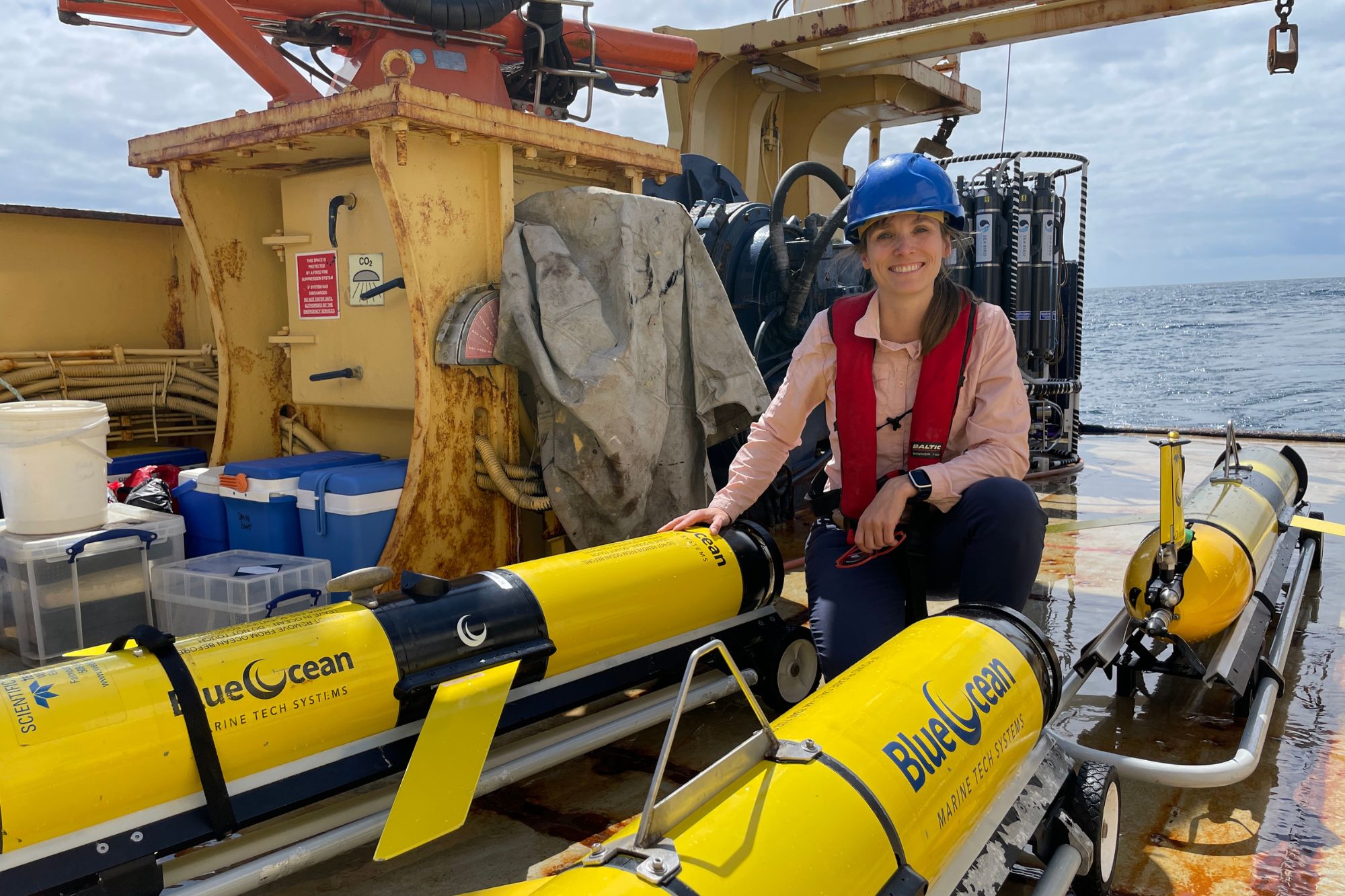
Above: Dr Juliane Wihsgott on board the PML Research Vessel Plymouth Quest alongside the 3 robotic gliders just prior to deployment.
WATCH VIDEO: SyncED-Ocean glider deployment
Harmful algal blooms (HABs) can present a direct threat to marine organisms, or indirectly by leading to detrimental conditions such as the rapid depletion of dissolved oxygen concentration in coastal waters.
Seasonally stratified* seas, such as those surrounding the UK, are susceptible to oxygen depletion events following HABs that occur through summer months in the Celtic Sea and Western English Channel, and have been associated with causing mortality of fish.
*What is ocean stratification?
Ocean stratification is the natural separation of an ocean’s water into horizontal layers of different density. This typically happens either when lighter freshwater from rivers or rain sits on top of heavier seawater in coastal regions, or seasonally as the spring and summer sun warms up the upper ocean layers. The resulting layering supports productivity by keeping plankton near the surface, and separates deeper layers from the otherwise ventilating effects at the ocean surface.
Better understanding and prediction of phytoplankton dynamics is essential to accurately inform decision making and management interventions related to HABs, to help promote healthy, biodiverse and productive seas.
Current methods of monitoring for HABs however require in-situ sampling and microscopic analysis, but large blooms from species such as Karenia mikimotoi can also be detected from space in satellite ocean colour images.
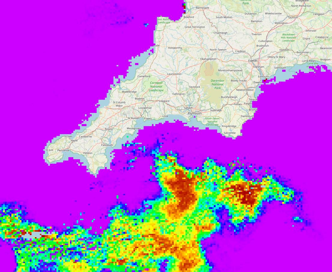
Above: A harmful algal bloom – Karenia mikimotoi – seen from space. This satellite image has been taken from the PML HAB watch portal on the 19th July 2022, demonstrating the extent and intensity (red colours) of the Karenia blooms in the Western English Channel.
While satellite data successfully captures HABs at the ocean surface, they cannot detect them beyond the optical depth, which may only be a few metres or less. As such, marine autonomous systems (MAS) like ocean gliders offer a solution for providing coincident sub-surface data within coastal and open ocean environments, and have the capability to simultaneously monitor oxygen concentrations associated with phytoplankton blooms as well as other ocean conditions.
The SyncED-Ocean project led by PML’s Professor Matthew Palmer is developing a Digital Twin Ocean in collaboration with partners at the MetOffice, University of Exeter and BODC. The Digital twin provides an optimised virtual “twin’ of the real-world ocean by linking models directly with the in-situ observations and satellite data. As the model is updated and improved with observations, the gliders are then directed by an AI decision making algorithm towards the areas of greatest uncertainty in the ocean model, or to areas that are predicted to be at risk from HABs or oxygen depletion over the next few days.
This week, PML Oceanographer Dr Juliane Wihsgott successfully deployed 3 autonomous robotic gliders in the Western English Channel with partners Blue Ocean Marine Tech Systems to kick start the Digital Twin Ocean. The gliders will be deployed for a month of continuous monitoring of ocean conditions that will be directly fed into the “virtual’ side of the Digitial Twin.
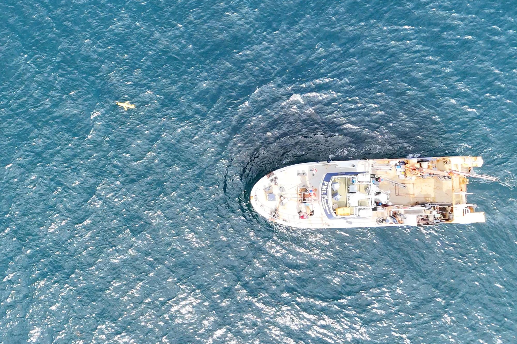 Above: One of the 3 deployed ocean gliders being sent off on its mission following deployment from the PML research vessel.
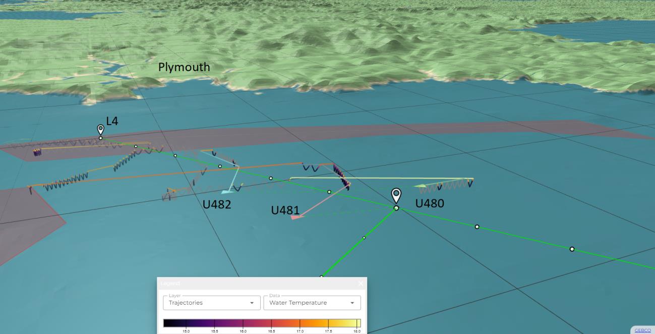
Above: Tracks and ocean temperature data from ocean gliders (U480, U481 &U482) since their deployment from the Western Channel Observatory L4 site on 6th August 2024.
Dr Gavin Tilstone and Dr Tom Jordan from PML’s Earth Observation Science and Applications group also deployed state-of-the-art semi-autonomous optical sensors to calibrate the glider data, and validate the data from satellite remote sensing images, optimising our capability to observe these HABs.
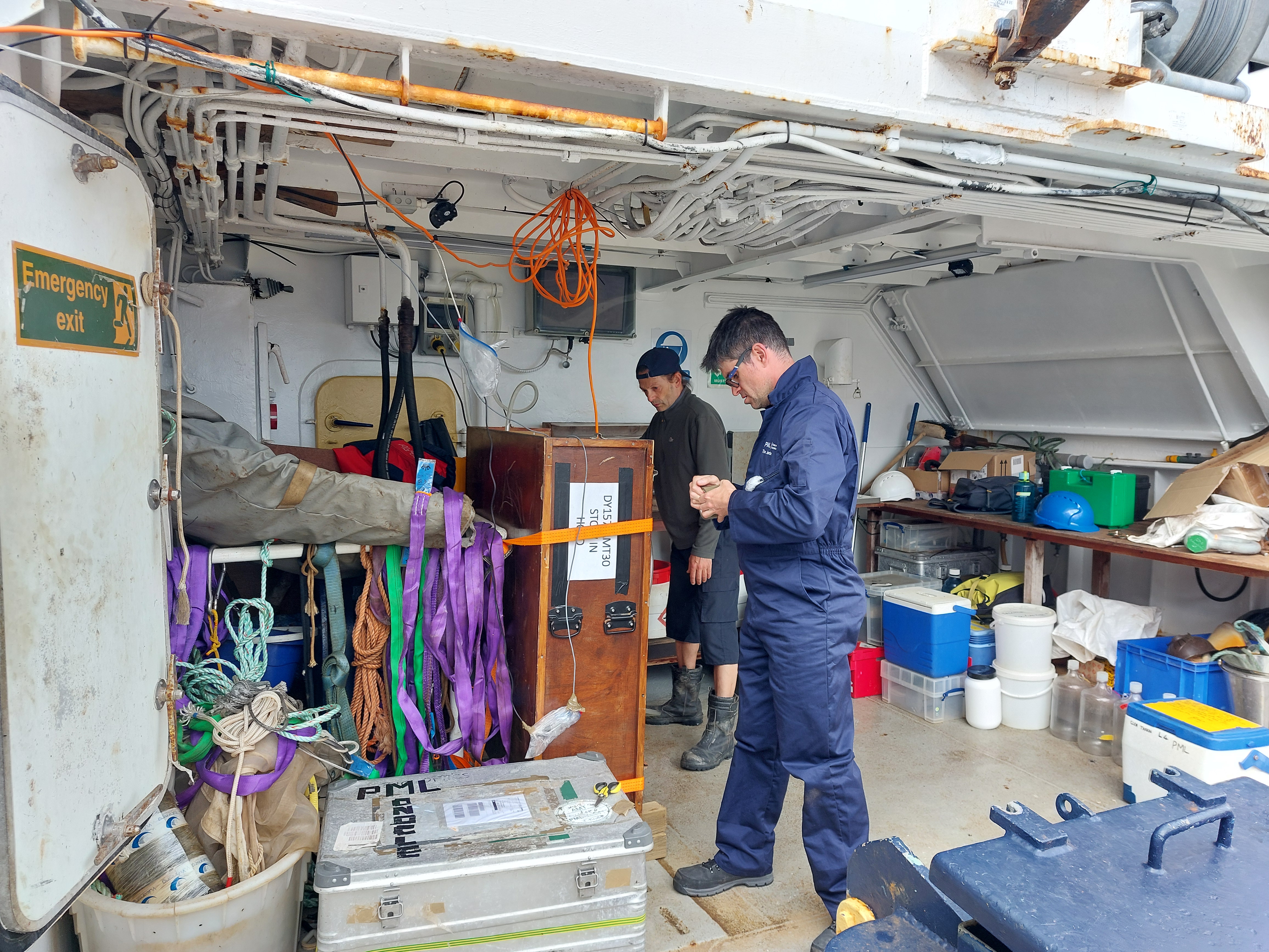
Above: Dr Gavin Tilstone (left) and Dr Tom Jordan onboard PML’s research vessel the Plymouth Quest testing the semi-autonomous optical sensor set up for measuring phytoplankton optical properties and biomass at high spatial resolution.
The robots will adapt continuously to the changing requirements of the virtual ecosystem twin, which is represented by a marine system model being run on the MetOffice-NERC MONSOON supercomputer. Data will continually be used to optimise the model to present the best possible predictions of HABs and reducing oxygen levels.
SyncEd-Ocean Project lead Professor Matthew Palmer explains:
“SyncEd-Ocean provides us with the best example yet of a true Digital Twin Ocean, where the real and virtual marine ecosystems are directly and continually linked via an AI decision making process that continually adapts our sampling strategy to improve prediction of our coastal seas. The framework we have developed is transferable to any part of our ocean globally, and can be used for a range of different purposes where in situ observations are needed to improve our ocean models, stretching well beyond the HAB and oxygen depletion focus of this project.”
Work package lead Dr Juliane Wihsgott added:
“I am excited to be part of the SyncEd-Ocean project to test and further develop the current capabilities of assimilating in-situ data into operational forecast. Three autonomous ocean gliders will be collecting new underwater data that will inform the forecast in almost real time. The continuous feedback loop between the virtual and the real ocean enabled by this Digital Twin framework then directs the gliders where the virtual system (the model) most needs new in-situ observations with minimal human oversight.”
Dr Gavin Tilstone added:
“This is an exciting development on the interface between underwater marine robotic vehicles, ocean sensors and AI technology in creating a digital replica of the ocean to better be able to predict the occurrence and outcome of a harmful algal bloom.”
Please stay tuned for more updates!
Related information
The SyncED-Ocean project is one of five projects that received part of the TWINE programme’s £2.8m fund, being delivered by the Natural Environment Research Council in partnership with the Uk Met Office.
The TWINE programme is part of a £200 million portfolio of 17 Earth Observation Investment Package (EOIP) projects, which were announced in November 2022. The aims of the TWINE programme and the successful projects collectively are to:
-
harness the UK’s leading position at the nexus of environmental, observational and computational sciences, and bring together multidisciplinary teams to realise the value of digital twinning technology to address environmental challenges
-
improve the understanding, modelling and prediction of events, inform future decision-making, and test the impacts of different scenarios and interventions to help make better decisions on improving our environment
-
build the foundations of a coherent and lasting landscape of digital twins for environmental science, with a high level of cross-fertilisation of learning and a focus on design for interoperability with current and future activities
